Road and Light Rail Archaeology
Road Investigations
Consideration of archaeology is fully integrated into the national road scheme planning process and is directly managed by the TII Archaeology & Heritage Section with a view to meeting our statutory obligations, observing best practice, controlling costs, contributing to the efficient delivery of national road schemes and disseminating the results of TII-funded archaeological investigations.
The Archaeology & Heritage Section is responsible for the management of the archaeological implications of national road projects. The management function is dictated by requirements in An Bord Pleanála approvals, as well as environmental and national monument legislation; in particular, conditions imposed by the Minister for Arts, Heritage, Regional, Rural and Gaeltacht Affairs as to how archaeological excavations are conducted and newly discovered sites and features are dealt with. These management functions are exercised through the procurement and management of archaeological consultants and, where appropriate, the works are undertaken directly by TII archaeologists.
The primary objective is to complete all archaeological works in advance of the commencement of construction so as to minimise the organisation’s exposure to risk and to minimise the consequential exposure to costs. This is of particular relevance to Design and Build contracts and Public Private Partnership contracts.
It is also a key objective to ensure that the vast quantity of information created by TII-funded work can be realised to its full potential and that the knowledge generated feeds back not only into the decision making and project planning process, but also that this knowledge is disseminated to the general public. These activities also make a valuable contribution to promoting a greater awareness of the past among local communities through which national road and light rail schemes pass.
The cumulative effect of the archaeological work undertaken regarding scheme management, best practice guidance, dissemination and research, ensures that TII not only fulfils its statutory obligations as set down in legislation and national policy, but also demonstrates the organisation’s commitment to meaningful compliance. These efforts also serve to place TII at the cutting edge of the development and application of new investigation and excavation technologies and techniques, with direct benefits for the efficiency of our work on archaeology on national road and light rail schemes. Collectively, these works support the organisation’s core objective of contributing to sustainable development.
Public Transport Investigations
Archaeological investigations and discoveries from the Luas and proposed Metro Lines
Archaeological investigations were carried out by the Railway Procurement Agency (RPA) and archaeological consultants on behalf of the RPA before and during construction of these two Luas lines.
Archaeological sites discovered on Luas Red Line (Line A) include a prehistoric complex, an Early Christian souterrain as well as some medieval activity at Ballymount, Co. Dublin, and post-medieval remains at Tram Street, Phoenix Street and O’Connell Street Lower.
There were no significant archaeological sites revealed on the Luas Green Line (Line B). Archaeological monitoring did, however, reveal such features as post-medieval limestone walls, a stone culvert and a refuse pit on St Stephen’s Green West, as well as basements and coal cellars associated with 18th- and 19th-century houses on Harcourt Street.
In February 2007, the RPA published Under the Tracks: a slice through Dublin's past, an archaeological newsletter summarising the archaeological discoveries on the existing Luas Red and Green lines. Archaeological and other technical reports relating to both Luas lines can be found in the Archaeology & Heritage library.
A considerable amount of archaeological investigation was carried out prior to and during the construction of Luas Cherrywood (Line B1) providing a unique opportunity to gain further insight into this area’s past. Archaeological works that took place included a geophysical survey, advance archaeological test-trenching, archaeological excavation and archaeological monitoring.
These works revealed three new significant archaeological sites, which were excavated by CRDS Ltd. A prehistoric habitation site was identified at Brennanstown which produced numerous fragments of Late Neolithic/Early Bronze Age pottery and stone tools. In the townland of Laughanstown another prehistoric habitation site was revealed, producing similar pottery to the Brennanstown site. Stone tools, such as the butt from a stone axehead and a small rubbing stone, were also recovered. Radiocarbon dates suggest that the site was occupied sometime during the Bronze Age and Iron Age as well. Evidence of 18th-century military activity associated with a nearby historic military camp was also identified. In Murphystown a medieval quarrying site was identified in the vicinity of the ruins of Murphystown Castle.
You can learn more about these archaeological discoveries in the Luas Cherrywood Archaeological Brochure. All of the archaeological and other technical reports relating to Luas Cherrywood can be found in the Archaeology & Heritage library.
A programme of pre-construction archaeological testing was carried out in September 2008 by Headland Archaeology Ltd along the route of Luas Citywest (Line A1). The aim of the testing was to determine the presence or absence of archaeological features or artefacts and develop a programme of archaeological works to reduce any negative effects on identified archaeological remains in advance of construction.
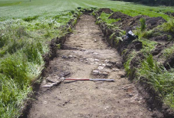
The work comprised the mechanical excavation of linear trenches, 2 m in width and totalling approximately 3.4 km in length, along the proposed route. All excavation was carried out under the direct and continuous supervision of an experienced archaeologist (Liam Hackett of Headland Archaeology Ltd). Where it was considered that a potential archaeological feature was present, mechanical excavation ceased and the feature was cleaned back and tested by hand. No significant archaeological features or artefacts were identified during the testing. Construction works for the Luas Citywest commenced in February 2009 and were monitored by Headland Archaeology Ltd. No significant archaeological features or finds were identified during the course of this work.
All of the archaeological reports relating to Luas Citywest can be found in the Archaeology & Heritage library. You can learn more about the archaeological heritage in the vicinity of Luas Citywest in the Luas Citywest: an archaeological landscape brochure.
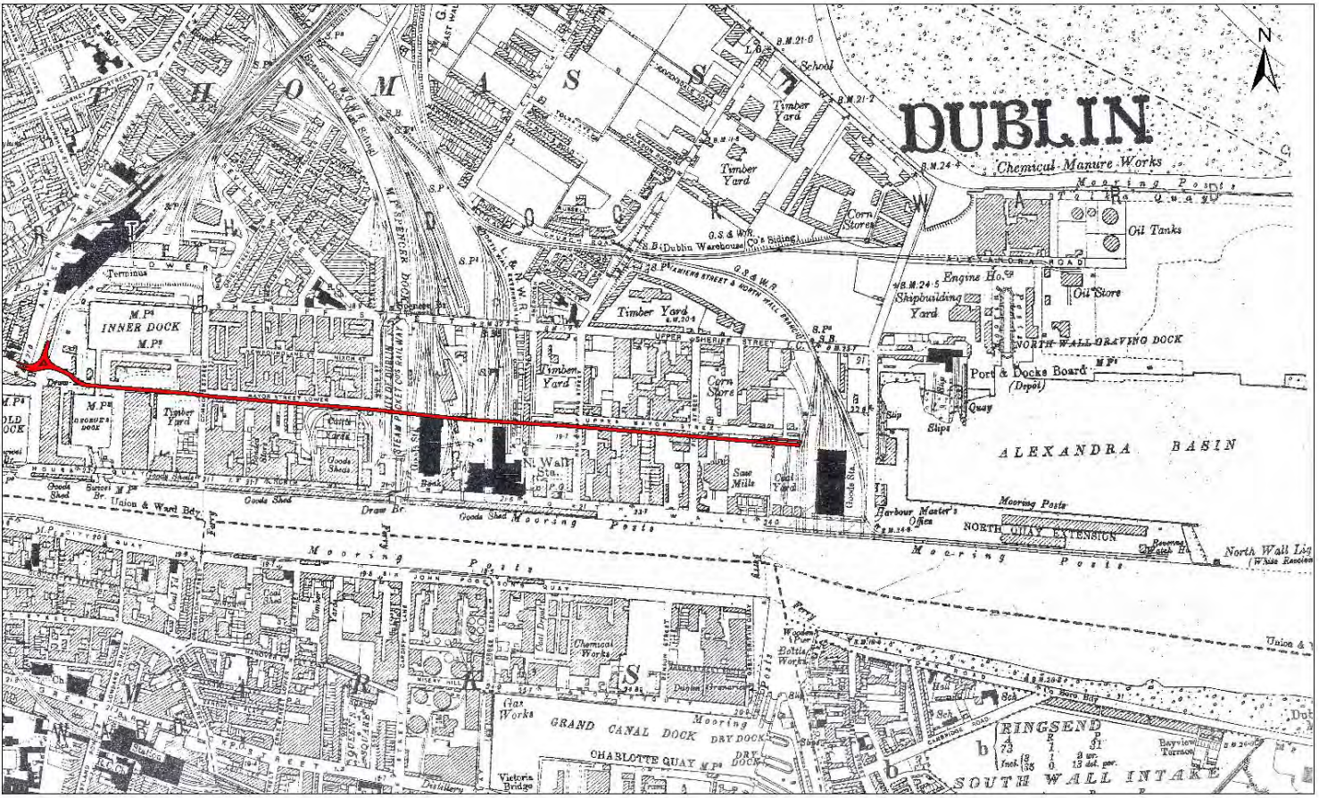
The Luas Docklands (Line C1) is in an area along the north side of the River Liffey that was reclaimed from the 1730s onwards. The majority of the land was used extensively in the 18th–20th centuries for heavy industry, rail and shipping, but evidence for much earlier use has been identified recently. During previous archaeological excavations as part of the Spencer Dock regeneration project, the remains of Mesolithic and Neolithic fish-traps were uncovered 150 m to the south of the newly-built Luas line. These internationally important traps were the earliest dated examples recorded in either Ireland or the UK.
The construction of the Luas Docklands was archaeologically monitored by the Railway Procurement Agency Archaeology Team between March 2007 and April 2008. No significant archaeological finds or features were identified during the course of these works. Monitoring did, however, reveal some interesting post-medieval features such as building foundations, bricked-lined sewers and a plank-lined drain all dating from the 19th century.
In the vicinity of the CHQ building, wall foundations belonging to buildings depicted on 19th-century Ordnance Survey maps were uncovered and identified as a tobacco store and a whiskey store. These remains were reburied and preserved in situ as they were not directly impacted by the Luas line. The brick-lined sewers were observed at several locations on Mount Street Upper and Lower. In some cases it was necessary to break through these sewers and reinforce them to prevent collapse. The plank-lined drain and a quantity of post-medieval glazed potsherds and two clay pipe stems were encountered at the site of an electrical substation at the Spencer Dock Stop.
The report on the archaeological monitoring can be found in the Archaeology & Heritage library.
In November 2009, McGovern Surveys conducted a condition survey at St Patrick’s Well, a recorded archaeological site reputedly dating to the fifth century, located in the grounds of Trinity College, beneath the northern side of Nassau Street (formerly St Patricks Well Lane). The earliest reference to this well is to be found in Jocelin of Furness’ 12th-century text Life of St Patrick. The site was restored in 1731 by Dublin Corporation. The results of this survey have been incorporated into the Environmental Impact Statement (EIS) for Luas Broombridge.
Advance archaeological testing at the location of the in-filled Royal Canal and Harbour at Broadstone, dating to the late 18th/early 19th century, was undertaken by Headland Archaeology Ltd in April 2010 in order to inform the detailed design and mitigation strategy at this location. Archaeological testing identified the location of the canal walls and a possible slipway into the canal. Human remains were also discovered at College Green during works. An article about this discovery was published in the Archaeology Ireland magazine in 2014.
The archaeological potential for the Luas Cross City (Line BXD) works was informed by the Archaeological Desktop Assessments of Dublin City (St Stephen’s Green to Dominick Street) and Constitution Hill (Royal Canal: Broadstone Branch and Harbour). Archaeological and other technical reports relating to the Luas Cross City can be found in the Archaeology & Heritage library.
A geophysical survey was carried out in November 2008 by Target Archaeological Geophysics in nine areas along the route of Luas Bray/Fassaroe (Line B2). Potential archaeological remains were identified in two of these areas. These included a possible building and a fulacht fia in Old Connaught townland. A fulacht fia is a site where water was heated for a range of purposes such as for use in a sauna or sweathouse, for domestic chores such as cooking, bathing and washing clothes, and for industrial activities such as leather-working and dyeing clothes. The mechanism for heating the water was to place stones that have been heated in fires into large water-filled pits. Fulachtaí fia generally date from the prehistoric period, particularly the Bronze Age.
Advance archaeological testing was undertaken by Irish Archaeological Consultancy Ltd in September 2010 in the vicinity of the possible building and fulacht fia. This investigation was carried out in order to establish the potential impact of the proposed Luas line on any identified archaeological remains, formulate an appropriate mitigation strategy to reduce any negative impacts and inform the final design. The testing confirmed that the possible building was not archaeologically significant and was, in fact, a configuration of relatively modern land drains filled with red brick. Archaeological testing did identify the remains of a fulacht fia within the proposed footprint of the Luas line.
The reports on the geophysical survey and advance archaeological testing can be found in the Archaeology & Heritage library. The Environmental Impact Assessment process for Luas Bray/Fassaroe is currently postponed.
A geophysical survey was carried out in February 2010 by J M Leigh Surveys for Irish Archaeological Consultancy Ltd (IAC Ltd) at three locations (Areas 1–3) within the Emerging Preferred Route corridor for Luas Lucan (Line F1). The geophysical survey results have indicated extensive disturbance probably originating from modern landscaping in Area 1, which is adjacent to King John’s Bridge. This disturbance may mask any potential archaeological remains. The possible remains of a demolished 19th-century house (Ballyowen House) have been identified in Area 2 and a possible boundary and other anomalies in Area 3.
The Environmental Impact Assessment process for Luas Lucan will commence shortly. IAC Ltd will prepare the archaeological component of the Environmental Impact Statement.
A Draft Archaeological Strategy has been prepared for Metro North. This strategy develops the measures set out in the Metro North Environmental Impact Statement to reduce and offset impacts on archaeological heritage arising from the project. The strategy was developed in consultation with the Department of the Environment, Heritage and Local Government and in line with the Code of Practice agreed between the Railway Procurement Agency and the DEHLG. The strategy considers all proposed works for Metro North, recognises that there are a series of diverse receiving environments across Metro North and outlines appropriate mitigation for each area and phase of works.
Broadly speaking, two different archaeological approaches are applied to ‘green field’ and to urban/developed environments on Metro North. In accordance with best practice, the management approach for archaeological investigation and subsequent resolution (archaeological excavation and recording or preservation in situ) in green field areas has been devised and sequenced with a view to ensuring that sections of the route, subject to land and site access, can be investigated and resolved at the earliest opportunity and, where possible, in advance of construction. The approach for urban/developed areas will comprise archaeological monitoring of construction activities and advance test-trenching of larger interventions (e.g. stop boxes). In the event that archaeology is identified at construction stage, an appropriate mitigation strategy will be formulated in consultation with the DEHLG.
A considerable amount of archaeological survey and investigation has taken place in advance of construction along the proposed Metro North route. This work was undertaken to further investigate the potential impacts on archaeological remains as a result of the Metro North project and to aid in the development of an appropriate mitigation strategy.
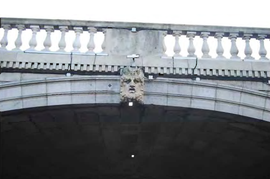
Underwater archaeological surveys of the River Liffey and the Broadmeadow and Ward Rivers were completed in December 2008 by the Archaeological Diving Company Ltd. As part of the River Liffey survey detailed descriptions were made of the riverbed topography, bottom composition, and existing river environment. A series of profiles were also taken, mapping the topographic changes encountered across the riverbed. No material, structures, or deposits of archaeological significance were encountered as part of the survey. The assessment area retains a number of historic features that were subject to detailed recording, these included two 19th-century quayside structures (Burgh Quay and Eden Quay), a bridge structure of late 18th- and 19th-century date (Carlisle/O’Connell Bridge) and a 19th-century timber revetment associated with Burgh Quay.
The Broadmeadow and Ward Rivers assessments consisted of a detailed survey of Lissenhall and Balheary Bridges, the riverbeds along the approach to and site of both bridges, and a survey of their banks. Balheary Bridge is a two-span bridge and Lissenhall Bridge is a five-span bridge that has a medieval origin, with much of the medieval fabric surviving. The assessment results indicated that Lissenhall Bridge and Balheary Bridge probably originally formed part of the same continuous structure that was built across the Broadmeadow and Ward river channels, thus illustrating that Balheary Bridge may also have had medieval origins. This was subsequently confirmed through ground penetrating radar and advance archaeological testing (see below). Lissenhall Bridge and Balheary Bridge will no longer fall with the constraint area of the Metro North project following the grant of a Railway Order by An Bord Pleanála in October 2010 for a modified Metro North route that extends only as far as the Estuary Stop.
An extensive programme of geophysical survey was carried out along the Metro North route between June 2008 and April 2009 by Margaret Gowen & Co. Ltd (MGL). A total of 50 green field sites were selected for the survey, which identified three potentially significant archaeology sites and numerous responses which may represent small-scale features such as pits or, in some cases, plough-damaged archaeological remains. In the townland of Belinstown two large subcircular enclosures were identified. Numerous responses suggestive of human occupation were identified within one enclosure and possible annexes were indicated radiating to the east of it. A possible archaeological complex was identified in the townland of Fosterstown South, south of Swords. This included at least two possible enclosures, one of which is D-shaped and the other quadrangular in shape. A ground penetrating radar survey was carried out at Lissenhall and Balheary in April 2009 by Murphy Surveys Ltd and the results of this were incorporated as an appendix to the final geophysical report. The survey identified responses which may represent an earlier continuous wall structure between Lissenhall Bridge and Balheary Bridge, spanning both the Broadmeadow and Ward rivers.
An extensive programme of advance archaeological testing in green field areas along the route was carried out by Headland Archaeology Ltd between 2009 and 2010. This investigation was undertaken to define the extent and nature of potential sites highlighted in the Environmental Impact Statement and by the geophysical survey, and to identify any further sites that may be present. Twenty potential archaeological sites were identified by testing, the vast majority having been evident as responses in the geophysical survey.
The testing confirmed the presence of enclosure sites at Belinstown, Fosterstown South and Ballystruan, all of which correlated with the geophysical survey results. In Lissenhall Little a ring-ditch and cremation pit were identified in an area not previously subject to geophysical survey owing to the presence of crops and three possible cremation pits were also identified in Ballystruan townland. Other sites identified include numerous features associated with burnt mounds/fulachtaí fia in Belinstown, Miltonsfield, Fosterstown South, Ballystruan and Ballymun. These sites were used for heating water for various domestic (e.g. washing clothes) and industrial activities (e.g. leather-working). Additionally trenching in Balheary Demesne confirmed the presence of an earlier structure linking the Lissenhall and Balheary Bridges, which correlated with the results of the ground penetrating radar survey.
Archaeological monitoring of 43 utility slit-trenches between Mater Hospital/North Circular Road in the north to St Stephen’s Green in the south was undertaken between May and July 2009. These trenches were excavated to identify the location, size and level gradient of all existing utilities and associated features, including underground culverts and basements. Thirteen slit-trenches were in proximity to three National Monuments: St Stephen’s Green Park, the Daniel O’Connell Monument and the William Smith O’Brien Monument.
Post-medieval archaeological features/deposits were identified at a number of locations. The remains included red brick cellars on D’Olier Street, Westmoreland Street and Parnell Square East, a mortared surface and a red brick coal chute on Parnell Square East, a possible stone wall on O’Connell Street and a metalled surface on D’Olier Street. At St Stephen’s Green, a single course of red brick was uncovered that may possibly have formed a brick surface and an arch-shaped brick cellar was encountered, along with a number of other disturbed post-medieval deposits. Several disturbed post-medieval deposits were identified in trenches excavated at the O’Connell Monument, along with a quantity of post-medieval pottery, two possibly worked flint fragments and a ceramic tobacco pipe stem. A possible cobble surface and a stone and red brick culvert were also encountered in the vicinity of the William Smith O’Brien Monument.
In accordance with the Metro North Draft Archaeological Strategy, the next phase of archaeological work to be implemented is a programme of archaeological excavation, which is proposed for 2011 as part of Metro North enabling works. This will include the full excavation and recording of sites identified during advance archaeological testing that will be impacted by the project.
All of the reports relating to the archaeological and geophysical investigations can be found in the Archaeology & Heritage library.
A number of archaeological investigations have been carried out as part of advance works for Metro West. In June 2008 a geophysical survey was undertaken in the vicinity of St Brigid’s Well, Clondalkin, by Target Archaeological Geophysics. The spring at St Brigid’s Well may have originally been venerated as part of a prehistoric pagan tradition that was later Christianised in the early medieval period. According to folklore it was used by St Brigid to baptise pagans in the fifth century. It is an important cultural heritage site which continues to be venerated today on a regular basis. It is also associated with a children’s burial ground that is recorded in literary sources and remembered locally. The geophysical survey was carried out to establish, if possible, the exact location of the burial ground in order to facilitate public consultation and design at this location (i.e. to avoid impacting on it); however, the survey results were inconclusive.
In June 2009 advance archaeological testing was undertaken in the townland of Merryfalls by Headland Archaeology Ltd, in order to inform the final design of the proposed Metro West depot. The remains of a late 18th-/early 19th-century structure, previously identified as the ‘Mad House’ on Taylor’s 1816 map, were identified by the testing. Additionally a programme of geophysical survey at 64 locations along the Metro West route was carried out in October and November 2009. The results of this survey indicate three main locations of potential archaeological settlement activity at Kildonan, Merryfalls and Silloge. These were archaeologicallt tested by Irish Archaeological Consultancy Ltd in late 2010 to provide information on the nature and extent of these potential sites.
Testing at Kildonan identified the remains of a subrectangular enclosure and two corn-drying kilns immediately south of the enclosure. The enclosure was defined by a ditch that may have been associated with a palisade fence, evidenced by two post-holes either side of the ditch. The enclosure and kilns possibly date from the early medieval period and may be contemporary with one another. In Ireland the two basic purposes for which kilns were constructed seem to have been to dry grain and to harden it prior to grinding.
Archaeological testing at Merryfalls identified the remains of a circular enclosure, tentatively identified as a ringfort, one of the most common forms of settlement during the early medieval period. They were often constructed to protect rural farmsteads, consisting of an internal habitation area delimited by an enclosing bank and ditch. Testing at Silloge identified a subrectangular enclosure, which is at present undated. The proximity of this site to the possible ringfort at Silloge and a medieval field system indicates that it may date from the early medieval or medieval periods.
The reports on the programmes of geophysical survey and archaeological testing can be accessed in the Archaeology & Heritage library.
In the event of scheme approval archaeological mitigation measures detailed in the Environmental Impact Statement, the archaeological component of which was prepared by the Railway Procurement Agency, will be implemented during the pre-construction, enabling and main infrastructure work phases of Metro West.